

Research Post Elevation © HNNA Ltd
RESEARCH POST
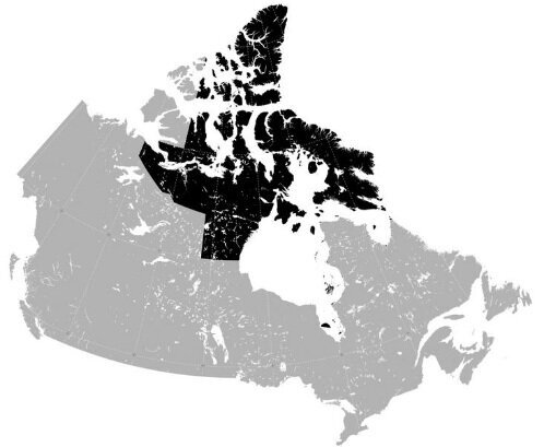
Location: Nunavut, Canadian Arctic
[ DEPLOYABLE STRUCTURE / HOUSING / EDUCATION ]
[ 0001 ]
A deployable live/work structure that adapts its form in accordance with the extreme seasonal adjustment of site and climate, using as a mechanism the change of state of water. The structure consists of three segments addressing water (regelation) air (accretion) and ground (levitation). Designed to be located on and around Devon Island, Nunavut in the Canadian Arctic.

Research Post Aerial View © HNNA Ltd
The aim is for the accommodation to adapt to the dramatic annual changes of both landscape and climate in these high latitudes, and to house the resultant change in work program of the inhabitant. As the freeze/thaw process underlies so much of the annual transformation, the compaction and dilution of the constituent parts of the scheme relate directly to the change of state of water. By researching areas of arctic geography, the effect of the arctic environment (particularly its structural implications), and scientific studies of changes incurred due to the freeze/thaw cycle the effects of this process can be harnessed and utilised.The siting, design and detail of the geological outpost are all entirely dependent on, and related to the cyclical nature of the freeze thaw process, The design can be broken down into three segments. Each strand of the building relates to one of three different aspects: ground, water and air, and the change of water content occurring in theses agents at different rates and for different durations.
Ice regelation
Multi-directional and sporadic movement of cables of different materials through ice.
Ice accretion
Accretion onto transmission lines and the snow loading and rotation that incurs along above ground cables.
Ice levitation
The effects of frost heave involving the active layer above the permafrost table.
Location Plan Image source: http://www.arcticadaptations.ca/project/

Aerial Site Photo Image source:http://tickiotock.tumblr.com
The Site
Nowhere is the trait of adaptation better exemplified than Canada’s newest, largest, and most northerly territory: Nunavut. Nunavut, which means “our land,” was separated officially from the Northwest Territories on April 1, 1999 following a land claims agreement established in 1993. Today, there are almost 33,000 people living in 25 communities, across a massive two million square kilometres. Over 60% of the population is under the age of 25, making it a young, dynamic urbanizing nation. Communities range in population from 120 in the smallest hamlet to 7,000 in Iqaluit, Nunavut’s capital city. This region is above the tree line and has no highways connecting communities. The myth of the Canadian north is tied to its unique geography – vast, sparsely populated and fragile. Yet Nunavut, like the entire Arctic region, is undergoing dramatic transformation as powerful climatic, social, and economic pressures rapidly collide.
The Landscape
From outer space ice, at or near the poles is the most significant variable feature on the earth’s surface. This variability is due to the annual freeze thaw cycle, and as such creates much movement, both surface and subterraneous, in a static dessert.
The landscape is one of inherent geological interest. Though it may appear a placid wasteland it contains much ground activity. The earth’s crust floats on a sea of molten rock; the additional dead weight of an ice sheet two kilometres thick, as was present at the Arctic Circle, depresses land levels as much as 300 metres. When an ice sheet melts, the land surface rebounds like a car ferry being offloaded. This phenomenon is called isostatic rebound, and the turmoil it ensues on the ground plane makes the area a geophysical fascination.
Near its melting point, ice is plastic, not rigid, by nature, and flows under the pressure of its own weight. Ice is larger in volume, less dense, more buoyant than water.
Crevasses in the ice open and close at changes of slope in the valley bottom, at doglegs in the valley walls, and where the glacier stumbles, disintegrating in sudden stages.
Within the landscape this expansion shatters bedrock. Like a liquid wedge, free water pours into crevices, freezes and expands, widening the crack but adhering the parts together until spring thaw. When the ice in the crevices melts, the rock is released. The meltwater seeps still farther into the crevices and refreezes when the ambient temperature drops again. This incremental action continues in a given location until rock tumbles downslope, exposing new rock to the freeze/thaw cycle.
When the watershed thaws in spring, river ice breaks up and rides a surge of melt water to the sea. In fine-grained, ice-rich soil, as is found in the Canadian Arctic, ice-wedge polygons, solifluction terraces, frost boils, sorted and non-sorted mud circles, thermokarst topography and drunken forest seem to compete for space in the landscape. Huge polygons form as frozen ground thaws and refreezes in annual cycles. Mounds called pingos, form as soil heaves upward over under-ground ice. All originate to some degree from the existence of permafrost and the freeze/thaw cycle.
The ground, except for a thin surface layer thawed each summer by the around the clock sunlight, is perennially frozen to depths sometimes exceeding a thousand metres. Continuous permafrost creates a tabletop just below the ground surface that is impervious to water flow. Sudden and cyclical changes in soil volume above the permafrost table create unstable conditions for building foundations.
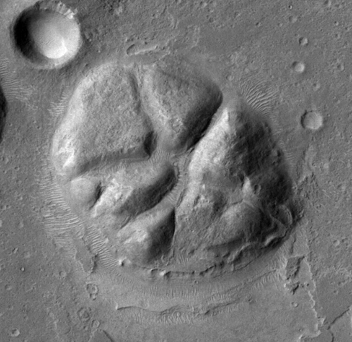
Moon Crater Image source: http://themis.asu.edu

Adaptable Access Arm Detail © HNNA Ltd
The Outpost
The outpost is positioned above the rim between geological ground changes. These ground changes are commonly found in theses latitudes due to historical geological unrest which arose as a result of the areas glacial past.
It is where the composition of the ground changes that melt water streams appear in summer. These silvery hieroglyphs, narrow valleys filled with thawed ground ice and snow, seem to appear from nowhere out of the snow plane of the winter dessert, these small valley networks were often channels for melt water formed at the edge of a shrinking ice cover,
The different hues of the meltwater streams are due to differences in mineral content, type of ice or depth. Geologists probe such lakes for signs of life or mineral/sediment information.
The ice cap is a time machine. Core samples of ice, from holes drilled more than a kilometre into the surface, reveal annual layer lines that contain trapped gases, soils etc.
Ice caps reveal human artefacts too, even buildings poorly adapted to the environment that have disappeared under snowdrifts in winter and then filled up with meltwater in summer. The ice cap swallows whole any stationary object and spits it out at the periphery, crushed, hundreds of years later.
Life too begins at the edge of the icecap on the plateau where valleys strewn with boulders carry ice and meltwater to the sea. One of the main functions carried out by the resident geologist in the scheme is to take and record the results from drill core sampling. In winter when the building compacts it becomes a lit display case for the most prised artefacts. Of the artefacts recovered natures redepositing means that they are not found in their original context, a fact that rules out stratigraphy as an age determinant.
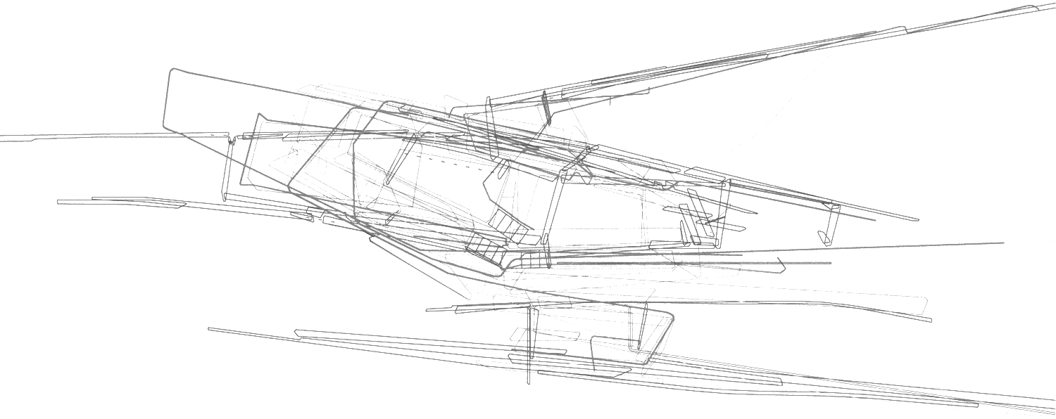
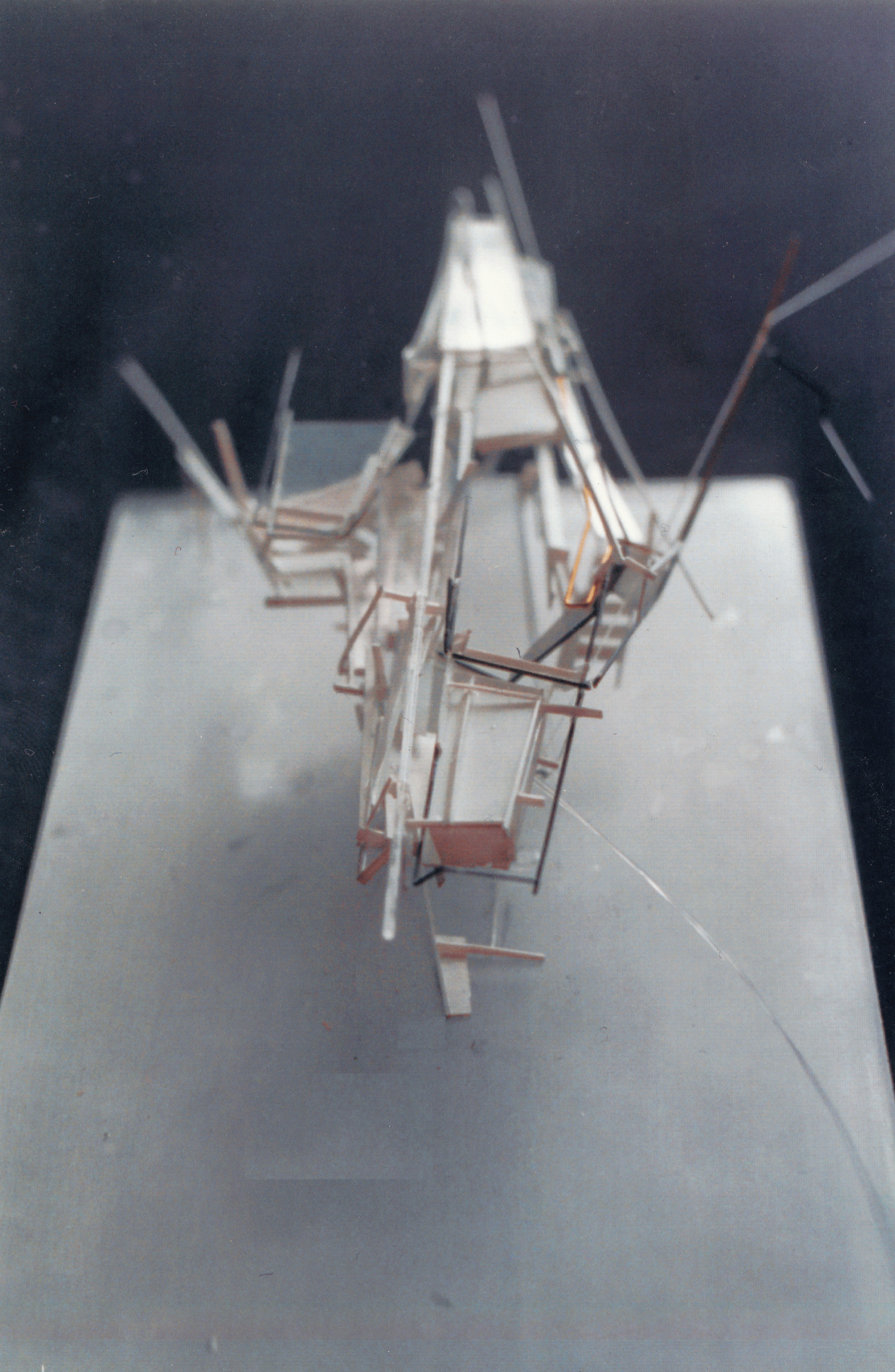
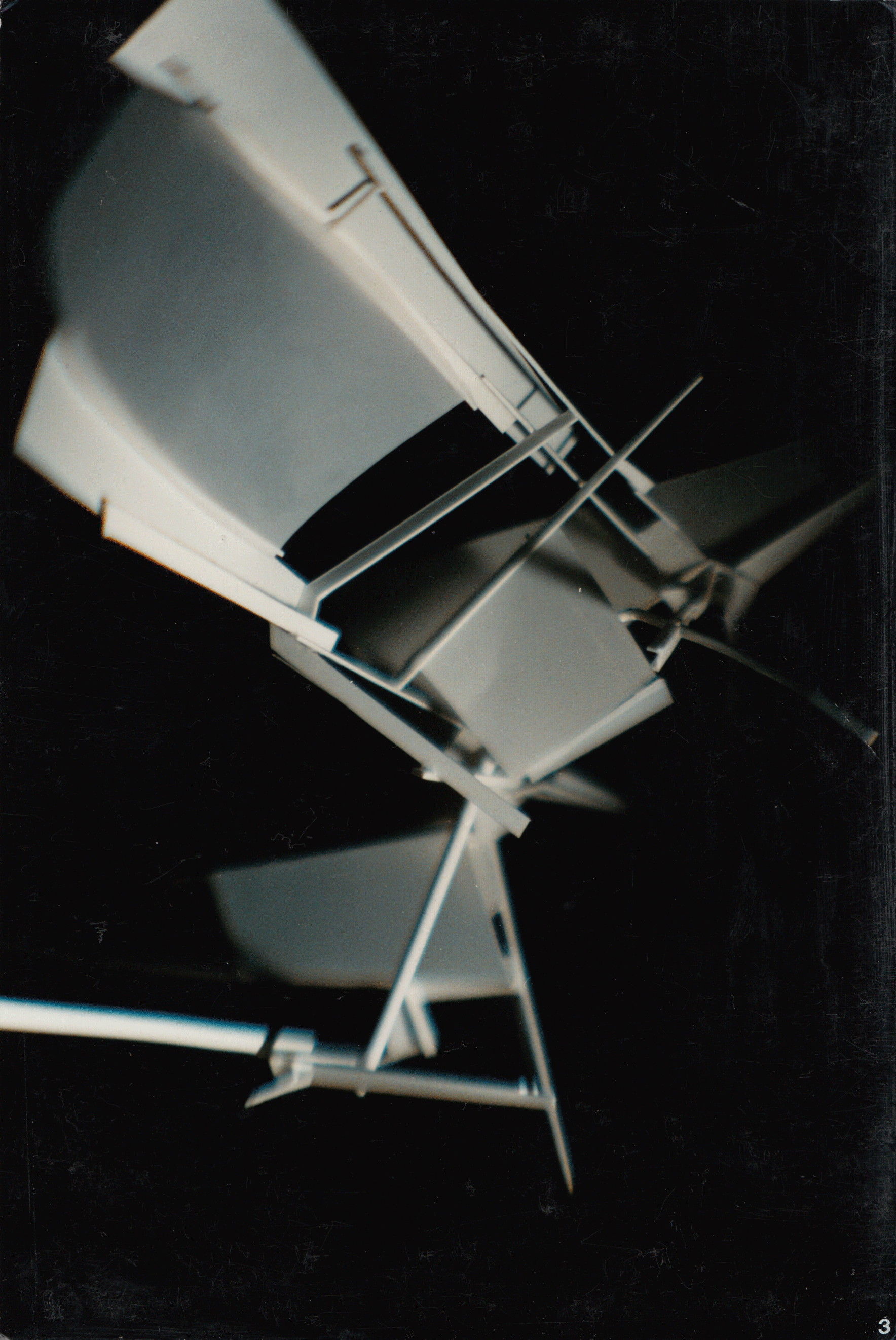
Research Post Diagram Showing the structural integration of the 4 elements © HNNA Ltd

Research Post Model Aerial Photograph © HNNA Ltd
Ice Regelation
Materials that contract while melting have a melting temperature (melting point) that decreases when pressure increases. Such materials, in solid state, swim on melting and exhibit the phenomenon of regelation. Ice is such a material.If a wire loop, or cable is slung around an ice block and loaded with a weight penetrates through the block without cutting it apart. The effect is due to regelation; the ice melts under the increased pressure of the weighted wire and the water freezes again when the pressure is released above the wire.
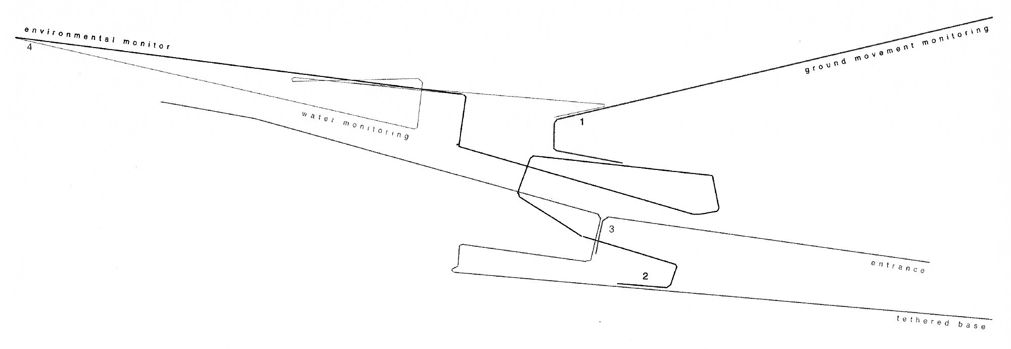
The main, primary segment, which lies centrally in the scheme, aligns and addresses the position of the margin between different ground conditions and therefore the position of the summer melt water stream.
This element is the only part of the building to be founded on a fixed base. The base support act as a jetty structure resting on the ground surface and waited down by a pivoting block of ice which controls the movement of the upper frame.

Water Surface Tension Image source: http://www.gifbin.com

Wire transitioning through ice © HNNA Ltd
The relationship of the ice block and the cables that service the house and that are strewn out over the stream when the ground service melts and the north easterly wind exhale them out from under the building, control the degree of compaction of the main spaces.
By looking at the way in which cables directionally move through the ice block as studied in an experiment by E.W.P. Hahne the phenomenon of the regelation of ice can be exploited to control the composition of the spaces in accordance with the climatic change. The instance of regelation is exploited within an ice block that is suspended below the main accommodation on a pivotable frame. The ice block itself acts as a weighting element against wind uplift, as a short-term structure capable of reassembly the element that weights the scheme in this respect does not need to be transported when the structure is relocated.
Regelation has been studied here as a potential means of controlling the movement of the ice block to adjust the main frame above and therefore adjust the degree of shelter and the extent of inhabitable space.
Research Post Plan © HNNA Ltd
Ice Accretion
The linear, secondary segment of the scheme orientates the design and acts as the tethering mechanism against the dominant northeasterly wind. This structure also provides the main servicing, and these cables along the main frame form the main aspect of the tether.
Forces imposed on these cables by ice accretion readjust the main frames position and the height and angle of its tethering effect. Study of the effect that ice accretion has on transmission cables means that an approximate calculation can be made of the extent, type and use of cabling within the scheme to allow it to perform as an adjustable tether.
The term ice accretion describes the process of ice growth on a surface exposed to the atmosphere. The phenomena of atmospheric icing can take place in several ways. In-cloud icing occurs when the cooling of an air mass promotes the supercooling of liquid water droplets.

Cable Tension Image source: http://www.thisiscolossal.com/2013/08/paolo-ceric-gifs/
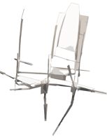
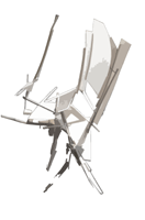
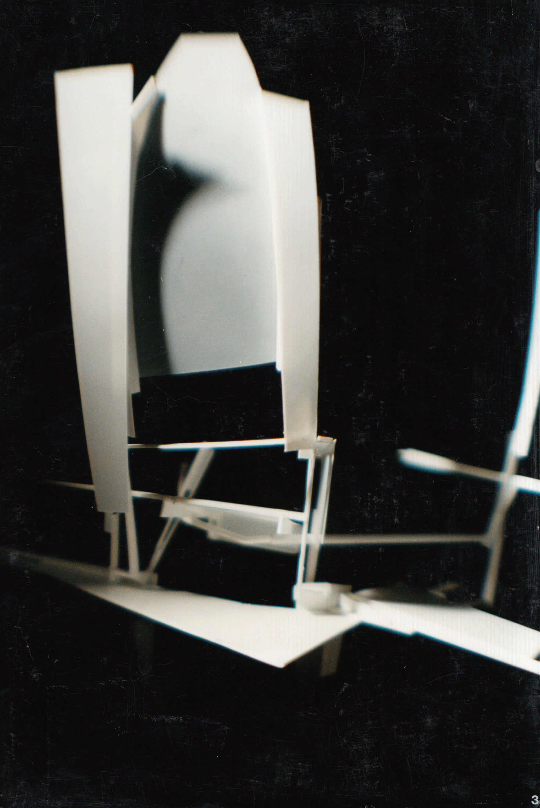
Sketch Model Photographs © HNNA Ltd
Ice Levitation
The third segment of the geological outpost relates to ground movement, its adaptation should be in accordance with the change of ground/soil temperature.
As the ground temperature changes the resultant frost heave raises and lowers the attached part of the scheme by means of a pivot to accentuate the action. Ground stability is fundamentally affected by the change of state of its water content. By looking at the way in which ice levitation affects pile foundations this movement can be exploited within the outpost scheme.
When air and ground temperatures are compared mean soil temperatures (one metre below ground) are shown to be several degrees Celsius higher than the respective mean air temperatures. The air temperatures peak and valley occur respectively a month after the summer solstices. The soil temperature (one metre below ground) peaks two months after the summer solstice. Since the snow cover insulates the ground from the warming air, and reflects much of the spring sunlight back into the sky, soil temperature begins to rise only in May, three months later than the air temperature. This shift means that the adaptation of parts of the building to shift from summer to winter conditions are not simultaneous, with the third segment of the design only actives in late spring.
Observation Seat
A deployable sheltered monitoring seat pitched on ice beds (part of Arctic based, deployable, Geological Outpost).
Like the Outpost, the seat responds directly to the change of state of water to adapt itself to protect the occupant against the rapidly changing and inhospitable climate.
Observation Seat © HNNA Ltd
Observation Seat Model Photographs © HNNA Ltd